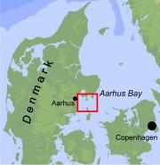
Aarhus Bay high resolution seismic survey with Genetica II
![]()
|
Cruise objectives
|
A focus area in the eastern part of the Bay was selected for a combined special survey of free gas distribution with improved hydroacoustic methods and a sediment sampling program with a dense station grid. The purpose of this campaign was to produce seismic data with high spatial resolution for calibrating the interpretation of seismic information with respect to the vertical distribution of gas by comparison with pore water profiles of methane concentrations. |

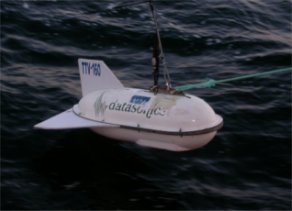 The survey was performed with a Datasonic CAP-6000 chirp sytem. The acoustic returns are measured with the receiving array on the tow fish. A penetration of 50-500 m in the sediments from sand to silt and a vertical resolution of 20 cm is expected. The spectrum of 1-10 kHz and a shot rate of 0.5 s gave good results in the survey area.
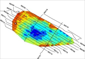
Detailed map of the depth of the upper limits of free gas.