- Movies
- Virtual Reality
Multimedia / Animation
Data from selected areas have been digitised and visualised in 3-D. Mainly the relationships between the seabed morphology and the occurrences of free gas in the subsurface in connection with other methane related features are shown. Virtual inspections of this computer animated graphics can be viewed as movie clips and/or as interactive Virtual Reality. For the interactive Virtual Reality you need a special software that can be downloaded from the internet as freeware.
Please use the information on the subpage "Virtual Reality".![]()
![]()
![]()
|
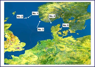
OVERVIEW The overview map on the right shows the locations from which spatial data were available. Data was made available to the project by the partners M. Hovland, STATOIL (No.1 - No.3) / H. Fossing, NERI and J. Jensen, GEUS (No.5), and by Rise et.al. (1999), MarPetGeol 16, p. 619-631 / Haugwitz & Wong (1993), MarGeol 111, p. 189-207 (No.4) |
MOVIES VIRTUAL REALITY |
 |