ArcIMS Help
![]()
The IMS Viewer you can access from these GIS-Websites is designed by using HTML and JavaScript. This implies certain requirements of the Internet browser you use. There should occur no problems in displaying the IMS with Internet Explorer 6 and younger, Mozilla Firefox, Netscape 7.1 and younger.![]()
A brief explanation of the main elements of the IMS screen are already given on the "Internet Map Server (IMS)"-Site.
What you will find here are detailed information and examples (see manual). -- A manual in pdf-format will soon be available here --![]()
See images of: ---
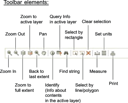
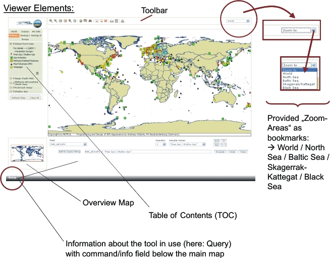
Toolbar Elements --- Viewer Elements![]()
 |
(Top of Page)
 |
(top of page)
Responsible: ©AWI-Bremerhaven (Prof. Dr. M. Schlüter / Dipl.-Geol. U. Fritsche)